


Cheesman Canyon Dam to Deckers
The Cheeseman Canyon section of Colorado's South Platte river is a narrow scenic canyon with Gold Medal fly fishing for trout with Phd's in avoiding your offerings - they've seen it all. Come on - you're smarter than a trout, right?
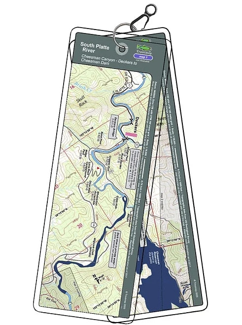
Because this is a hiking/wading river only, the Troutmaps are at a larger scale for greater detail over the short 3.3 river miles from the Gill Trail to Cheesman Dam.
2 river maps and 2 area maps
Product Info:
- Laminated and waterproof maps that follow the river channel.
- Individual maps are secured with a stainless steel split ring, and includes a snap hook that allows clipping to a cable retractor on waders or boat.
- Cable retractor is not included
- River features such as rapids, boat ramps, access points, and campgrounds are clearly shown.
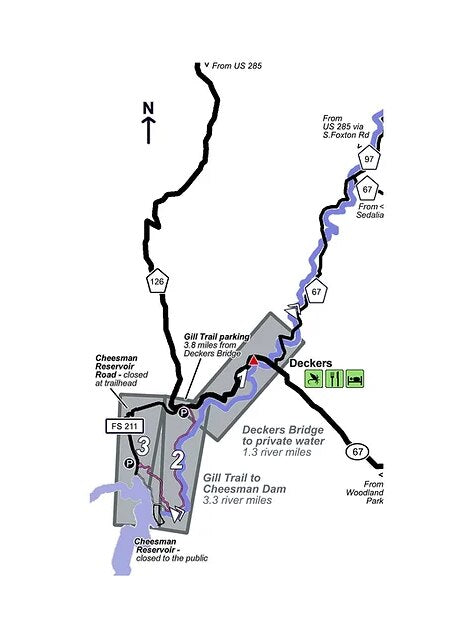
- Each map set contains an area map showing the general location of fly shops, shuttles, lodging, fuel and places to eat.
- Approximate size: printed map: 3-3/8 inches by 10-1/4 inches; laminated page: 3-3/4 inches by 10-1/2 inches.

